Shrine & Marshland - Nikko-Oze / 社寺與濕原 - 日光尾瀨登山地圖(栃木・群馬・福島)
AW3D30.OSM - Nikko-Oze TOPO v2026.07.25
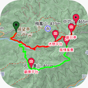
適合用在 Garmin / Android / iOS 上的離線地圖。
地圖範圍
- 緯度範圍: N36.50 ~ N37.47
- 經度範圍: E138.68 ~ E139.86
著名的山頭 (Famous Peaks)
日光地區(栃木縣為主)
- 男體山 (Mount Nantai, 2,486m, 日本百名山,山頂二荒山神社奧宮所在,日光信仰的中心)
- 女峰山 (Mount Nyoho, 2,483m,與男體山、太郎山合稱「日光三山」)
- 太郎山 (Mount Taro, 2,368m)
- 日光白根山, 奧白根山 (Mount Nikko-Shirane, 2,578m, 日本百名山,關東地方最高峰)
- 那須連峰/茶臼岳 (Nasu Mountain Range/Mount Chausu, 1,915m, 日本百名山,現役活火山)
尾瀨地區(群馬・福島・新潟交界)
- 燧岳 (Mount Hiuchigatake, 2,356m, 日本百名山,東北地方最高峰)
- 至仏山 (Mount Shibutsu, 2,228m, 日本百名山,蛇紋岩地形孕育高山植物群落)
- 會津駒之岳 (Aizu-Komagatake, 2,133m, 日本百名山)
- 赤城山 (Mount Akagi, 1,827m, 日本百名山,複式火山,山頂大沼湖景致優美)
- 皇海山 (Mount Sukai, 2,144m, 日本百名山)
著名的健行路線 (Famous Trekking Routes)
日光地區(栃木縣為主)
- 戰場之原步道 (Senjogahara):中禪寺湖畔延伸至湯元的高原濕地木棧道,四季景色分明
- 湯瀑布-湯元溫泉步道:沿湯瀑布至湯之湖、湯元溫泉的短程步道
- 霧降高原小丸山步道:可眺望日光連山,秋季紅葉與六方澤橋景致著名
- 男體山登拜道:二荒山神社中宮祠起登,往返約需一整日,為日光信仰傳統登拜路線
- 日光白根山空中纜車步道:搭乘纜車至山頂駅後往返登頂,是關東最高峰最容易親近的路線
尾瀨地區(群馬・福島・新潟交界)
- 尾瀨之原橫斷縱走(Ozegahara):貫穿尾瀨濕原核心的木棧道,6 月水芭蕉、8 月尾瀨龍膽花季最為熱門
- 尾瀨沼環湖步道:環繞尾瀨沼一周,可眺望燧岳倒影
- 見晴-溫泉小屋群步道:尾瀨之原東側山屋聚落,是縱走途中重要中繼點
- 燧岳登頂路線(御池或沼山峠起登,往返尾瀨沼)
- 至仏山登頂路線(鳩待峠起登,山頂可俯瞰尾瀨之原全景)
著名景點
- 日光東照宮 (Nikko Toshogu):德川家康廟所,1999 年與二荒山神社、輪王寺共同登錄 UNESCO「日光社寺」世界文化遺產
- 中禪寺湖 (Lake Chuzenji):男體山火山活動堰塞而成的高山湖泊,湖畔溫泉旅館林立
- 華嚴瀑布 (Kegon Falls):落差 97 公尺,日本三大名瀑之一,中禪寺湖唯一出水口
- 龍頭瀑布、湯瀧 (Ryuzu Falls, Yudaki Falls):奧日光著名瀑布景點,秋季紅葉尤其壯觀
- 奧日光湯元溫泉:日光最深處的溫泉鄉,緊鄰湯之湖與湯瀧
- 鬼怒川溫泉 (Kinugawa Onsen):栃木縣代表溫泉鄉之一,鄰近日光市區
- 尾瀨濕原 (Ozegahara):日本最大高山濕原,1960 年代保育運動發源地,現為拉姆薩公約濕地
- 那須溫泉鄉:那須連峰山麓溫泉群,皇室御用那須御用邸所在地
歷史事件
- 782 年日光開山:相傳勝道上人成功登頂男體山、開創日光信仰之始,其後於山麓建立寺院,奠定日光作為靈山聖地的基礎。
- 1617 年日光東照宮創建:德川幕府為奉祀開府將軍德川家康(東照大權現)而建,此後日光成為江戶幕府最重要的宗教與政治象徵之地,歷代將軍皆定期參拜(日光社參)。
- 1949 年〈夏の思い出〉歌曲問世:這首描繪尾瀨水芭蕉花海的名曲傳唱全日本,使原本僻遠的尾瀨濕原一躍成為國民度假勝地,也埋下日後保育運動的種子。
- 1949-1996 年尾瀨保育運動:政府原計畫在尾瀨之原修建道路與水壩,遭民間發起長期保育抗爭,最終計畫全數撤回,尾瀨因此被視為日本自然保育運動的先驅案例。
安裝/下載連結
相關網頁
- 魯地圖分流器 (Cedric Shih)
- 說明網頁:
- https://moi.kcwu.csie.org/nikko_oze_topo.html (mirror kcwu)
- https://map.happyman.idv.tw/rudy/nikko_oze_topo.html (mirror Happyman)
- 使用討論(臉書社團): https://www.facebook.com/groups/taiwan.topo
- 開發網站(GitHub): https://github.com/alpha-rudy/taiwan-topo
 自動安裝
自動安裝- 請於 APP 內直接安裝地圖
安裝示範影片:https://youtu.be/HP6BXKdBUvg
- 主地圖,請貼網址: https://rudymap.tw/AW3D30_OSM_Nikko-Oze_TOPO_Rudy.map.zip
- 地圖樣式,請貼網址: https://rudymap.tw/MOI_OSM_Taiwan_TOPO_Rudy_hs_style.zip
- 地形渲染,請貼網址: https://rudymap.tw/nikko_oze_hgtmix.zip
- 請於 APP 內直接安裝地圖
 自動安裝
自動安裝- 點選下列連結來啟動安裝,也可於 APP 內直接下載來安裝地圖
安裝示範影片:https://youtu.be/g8b15RPZ7nA
- 傳統版
- 三合一
- 離線地圖
- 風格主題 (0.4MB)
- 高程檔
- 三合一
- 點選下列連結來啟動安裝,也可於 APP 內直接下載來安裝地圖
 綠野遊蹤自動安裝
- 安裝時,請隨意點選任一站台就可以 (不用重複點選)
安裝示範影片:https://youtu.be/JsvP61CErYY
- 傳統版
- 三合一
- 離線地圖
- 風格主題 (0.4MB)
- 高程檔
- 三合一
- 安裝時,請隨意點選任一站台就可以 (不用重複點選)
 OruxMaps (歐魯妹) 自動安裝
- 安裝時,請隨意點選任一站台就可以 (不用重複點選)
安卓 11(含) 以後:安裝示範影片:https://youtu.be/8hwJr4jMsE0
安卓 10(含) 以前:安裝示範影片:https://youtu.be/GbBaePfk4cE  Map
Map
 Style (0.4MB)
 請點選下載,並手動安裝
- 安裝時,請隨意點選任一站台就可以 (不用重複點選)
 Locus Map 自動安裝
- 安裝時,請隨意點選任一站台就可以 (不用重複點選)
安裝示範影片:https://youtu.be/rb1Hb6dkGkw
- 分開安裝
 Map
Map
 Style (0.4MB)
 DEM mix, v2025
- 圖資更新
- 更新
- 三合一
- 首次安裝
- 安裝時,請隨意點選任一站台就可以 (不用重複點選)
 iOS/Android Cartograph Maps 自動安裝
- 安裝時,請隨意點選任一站台就可以 (不用重複點選)
安裝示範影片:https://youtu.be/FDa2Qb9wxUY
- 分開安裝
 Map
Map
 Style (0.4MB)
 DEM mix v2025, 請點選下載,並手動安裝
- 圖資更新
- 更新
- 三合一
- 首次安裝
- 安裝時,請隨意點選任一站台就可以 (不用重複點選)

 Mapsforge 手動下載自行安裝
- 安裝時,請隨意點選任一站台就可以 (不用重複點選)
- Map
- OruxMaps/綠野遊蹤/蛙弟/山林日誌 POIv3
- Cartograph POIv2
- Locus POI
- OruxMaps/綠野遊蹤/蛙弟/山林日誌 Style (0.4MB)
- Locus Style (0.4MB)
- Cartograph Maps Style (0.4MB)
- 30m HGT
- 疊圖專用 Styles
- BN Style, 給深色地圖疊圖 (例:衛星地圖) (0.4MB)
- DN Style, 給淡色地圖疊圖 (例:通用電子地圖) (0.4MB)
- TN Style, 給高度圖疊圖 (例:Relief Map) (0.4MB)
- Extra Style, 給 Cartograph Extra 圖層疊圖 (0.4MB)
- BN Style, 給深色地圖疊圖 (例:衛星地圖) (0.4MB)
- 安裝時,請隨意點選任一站台就可以 (不用重複點選)
 Garmin MOI.OSM.camp3D - Nikko-Oze Region(適合 PC/Mac BaseCamp)
- 安裝時,請隨意點選任一站台就可以 (不用重複點選)
 camp3D
 camp3D
- camp3D
- 安裝時,請隨意點選任一站台就可以 (不用重複點選)
- Garmin English Maps - Nikko-Oze Region
- Clip on one of mirrors to download
- Installation demo on Windows: https://www.facebook.com/groups/taiwan.topo/permalink/726308367524779
- Installation demo on macOS: https://www.facebook.com/groups/taiwan.topo/permalink/726303937525222
- camp3D
- en_camp3D
- en_camp3D
- Clip on one of mirrors to download
版權宣告
OpenSteetMap
© OpenStreetMap contributors
本作品內含部份資訊取自「OpenStreetMap」https://wiki.openstreetmap.org/wiki/Downloading_data,該資料庫以開放資料庫授權條款 (Open Database License, ODbL) 進行提供。
License: http://www.openstreetmap.org/copyrightJAXA ALOS World 3D - 30m (AW3D30) Version 4.1
部分範圍的等高線與 HGT DEM 來自於JAXA AW3D30 v4.1。
使用檔案:N36E138, N36E139, N36E140, N37E138, N37E139, N37E140。
Link: http://www.eorc.jaxa.jp/ALOS/en/aw3d30/index.htmGMAP Styles and TYP
Garmin GMAP Styles and TYPs are origin from Freizeitkarte.
Link: http://www.freizeitkarte-osm.de/garmin/en/index.htmlMapsforge Style
Symbols/patterns/code is derived and based on OpenAndroMaps Elevate theme by Tobias Kühn.
Link: http://www.openandromaps.org/en/legend/elevate-mountain-hike-theme
Detail Link: http://www.openandromaps.org/wp-content/users/tobias/licenses.txt
Theme style is licensed under a Creative Commons Attribution-NonCommercial-ShareAlike License 3.0 Unported License.
Link: http://creativecommons.org/licenses/by-nc-sa/3.0/Tool of Contour Lines: gdal and phyghtmap
Contour lines of this map were generated by using tools “gdal” and “phyghtmap”.
gdal Link: http://www.gdal.org
gdal License: http://svn.osgeo.org/gdal/trunk/gdal/LICENSE.TXT
phyghtmap Link: http://katze.tfiu.de/projects/phyghtmap/
phyghtmap License: http://gnu.org/licenses/gpl.htmlTools of Maps: osm, mkgmap, and mapsforge
OSM Maps were built using the tools “osmosis”
Link: http://wiki.openstreetmap.org/wiki/Osmosis
GMAP Maps were built using the tools “splitter” and “mkgmap”
Link: http://www.mkgmap.org.uk/
License: http://gnu.org/licenses/gpl.html
Mapsforge Maps were built using the tools “Mapsforge Map-Writer”
Link: https://github.com/mapsforge/mapsforge/blob/master/docs/Getting-Started-Map-Writer.md
地圖版權與散佈說明
Copyright (c) 2025-2026 Rudy Chung
All rights reserved.

Redistribution and use in source and binary forms, with or without
modification, are permitted provided that the following conditions are met:

    * Redistributions of source code must retain the above copyright
    notice, this list of conditions and the following disclaimer.

    * Redistributions in binary form must reproduce the this copyright notice
    (or the HTTP link to this notice), this list of conditions and the
    following disclaimer in the documentation and/or other materials provided
    with the distribution.

    * Redistributions with modification must use a different map name which
    could be easily and clearly to be distinguished with this map.

    * Neither the name of Rudy Chung nor the names of its contributors may be
    used to endorse or promote products derived from this software without
    specific prior written permission.

THIS MAP IS PROVIDED BY THE COPYRIGHT HOLDERS AND CONTRIBUTORS "AS IS" AND
ANY EXPRESS OR IMPLIED WARRANTIES, INCLUDING, BUT NOT LIMITED TO, THE IMPLIED
WARRANTIES OF MERCHANTABILITY AND FITNESS FOR A PARTICULAR PURPOSE ARE
DISCLAIMED. IN NO EVENT SHALL RUDY BE LIABLE FOR ANY
DIRECT, INDIRECT, INCIDENTAL, SPECIAL, EXEMPLARY, OR CONSEQUENTIAL DAMAGES
(INCLUDING, BUT NOT LIMITED TO, PROCUREMENT OF SUBSTITUTE GOODS OR SERVICES;
LOSS OF USE, DATA, OR PROFITS; OR BUSINESS INTERRUPTION) HOWEVER CAUSED AND
ON ANY THEORY OF LIABILITY, WHETHER IN CONTRACT, STRICT LIABILITY, OR TORT
(INCLUDING NEGLIGENCE OR OTHERWISE) ARISING IN ANY WAY OUT OF THE USE OF THIS
MAP, EVEN IF ADVISED OF THE POSSIBILITY OF SUCH DAMAGE.